The AEMET awaits the arrival of what could become the first heat wave of the summer in Spain, which meets the criteria of intensity, extension and duration, and which will raise thermometers above 40ºC in the south of the Peninsula from Friday until Tuesday.
At night, tropical nights will be recorded, in which the thermometer will not drop below 20ºC in the Mediterranean, in the south and in the center of the Peninsula and it is possible that on the hottest days, they will not drop below 25ºC, called “nights torrid” at points in the southern half.
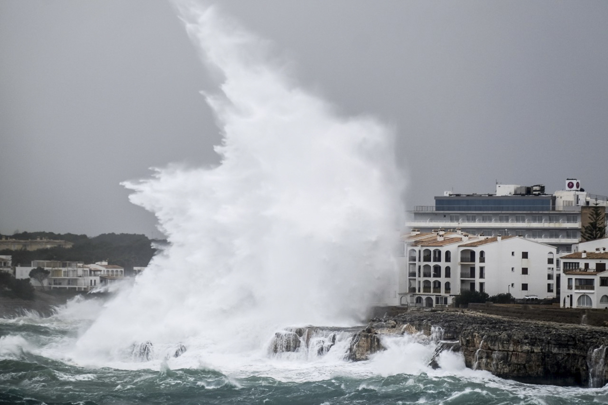
Today, six provinces will have a yellow risk warning due to high temperatures, winds or coastal phenomena, as reported by the State Meteorological Agency, which highlights the thermal rise that will be experienced during the day in much of the country except in the extreme north. and the strong winds that will blow in the Ampurdán, in the lower Ebro and in points of the Canary Islands.
Thus, Córdoba, Huelva, Jaén and Seville will have temperatures that may reach 38 degrees Celsius; while Girona will be at risk due to coastal phenomena, since winds from the north and northwest with force 7 will blow in the area, causing waves of three meters. In Tarragona, for its part, the yellow warning has been activated by winds, which will blow with gusts of up to 70 kilometers per hour.
At the beginning of the day the skies will be cloudy in the Cantabrian area where some light rains may occur, although throughout the day it will tend to be slightly cloudy. They will also have cloudy intervals at the beginning in Galicia, around the Iberian system, the Pyrenees, and with the possibility of a weak shower in eastern Catalonia and the Balearic Islands, although it will also tend to be slightly cloudy in all these areas.
In the rest of the Peninsula and the Balearic Islands the sky will be slightly cloudy or clear all day, while in the Canary Islands, the skies will be cloudy or with cloudy intervals in the north of the islands, and slightly cloudy in the south. However, the AEMET does not rule out the possibility of registering a bank of morning fog in the interior of Galicia and the Bay of Biscay, and haze in the Canary Islands and Melilla.
The maximum temperatures will rise on the peninsular Atlantic slope and lower Ebro, and will drop in the southern half of the Mediterranean area, the eastern Cantabrian Sea and the Ebro valley. In the rest, no significant changes will be experienced, as in the minimum.
Finally, the wind will blow from the north component in the northern half of the peninsula, Menorca and the Canary Islands, with strong intervals in the Ampurdán, lower Ebro and the Canary Islands. From this component in the coasts of the peninsular southeast and the rest of the Balearic Islands.
Conforms to The Trust Project criteria


